|
|
You are here: Walking Wiki>Walks Web>KanderSteg>KanderstegWalks>WalkAdditions4 (28 Jun 2010, JaneCurry)Edit wiki textEdit Attach
Allmenalp - First - Golitschenpass
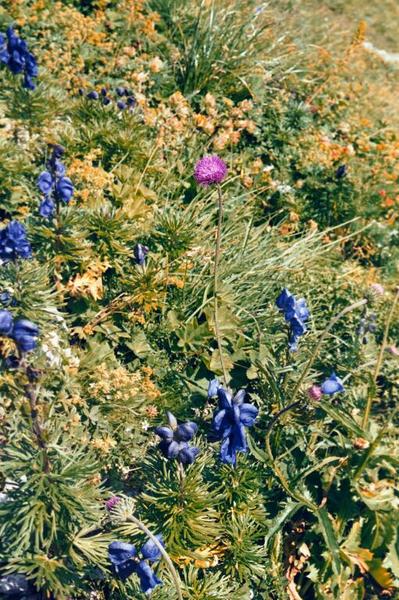
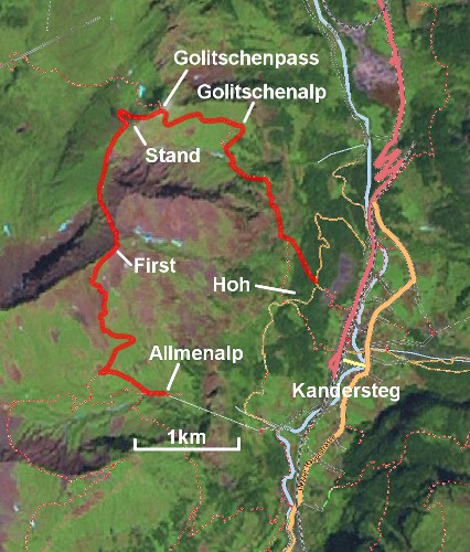
Walk donated by Charles and Margaret Clement. First is possibly the finest viewpoint accessible to walkers around Kandersteg. Horoang from First: Choose a fine day and you will have extensive views in all directions, even reaching the distant giants, Eiger, Monch and Jungfrau, of the Bernese Oberland. The summit ridge is exposed, and should not be attempted in thundery weather. Start from the Allmenalp cable terminus, or the nearby restaurant, taking the path up the valley towards the Bunderspitz. It is 825m up to First, and, for those experienced in some easy scrambling with exposure, it is very worthwhile to go on from there to the Golitschenpass and then the long way down to Kandersteg. The higher parts of the route, not easily accessible to sheep, are rich in alpine flowers.
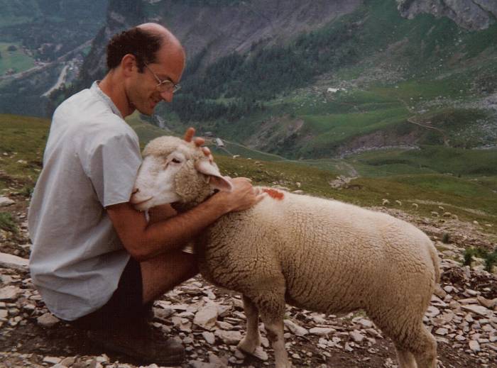
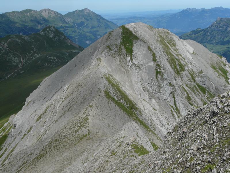
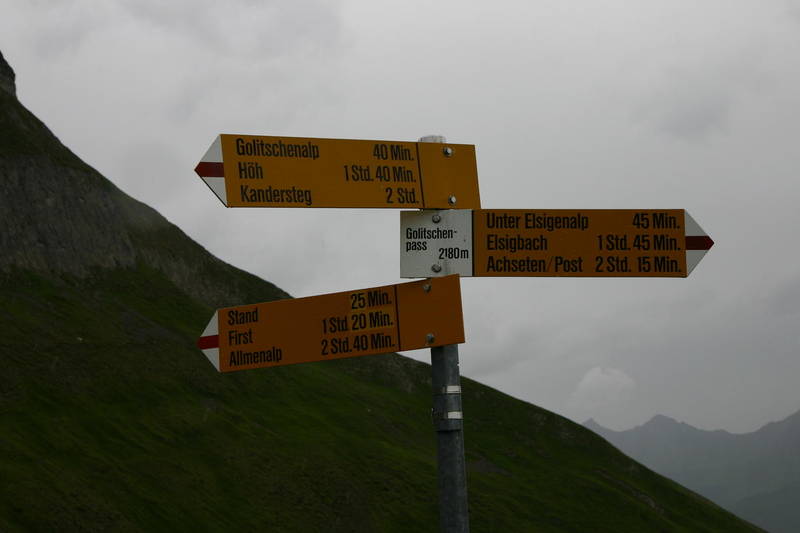
 After about a kilometre up the valley, the path to First turns off sharply to the right, ascends steeply, and then traverses horizontally to a hut at 2027m. Friendly sheep will often be found in the vicinity. From the hut, the path turns left and ascends steeply up the mountain with many zigzags before it finally reaches the summit ridge. The summit is a short distance along the ridge, and lunchtime with superb views will be enjoyed there by several people on a fine day. Beyond the summit, the short steep rocky descent down the narrow ridge to the col between First and Horoang is safeguarded by wire handrails and ropes. The path then traverses downwards on scree and rock slopes around the back of Horoang before it reaches grassy pastures at a col from where a path descends to alps above the Adelboden valley. Continue up a short ascent to the summit of Stand, another fine viewpoint. From there, it descends steeply to the left, before traversing horizontally across the steep North face of Stand to reach the Golitschenpass.
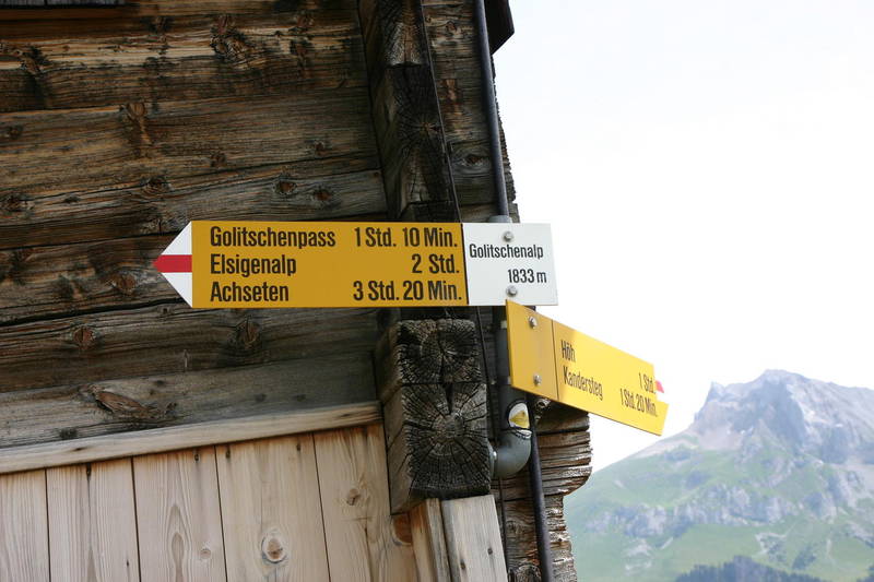
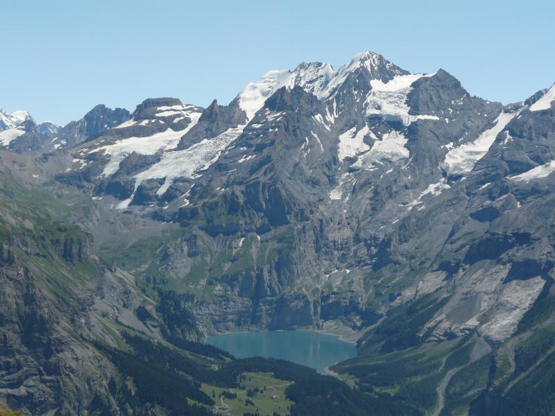
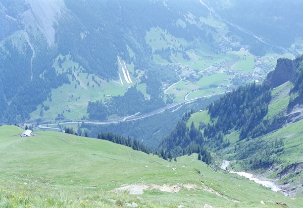
From the pass, there is a good path down the 1000m to Kandersteg, leading initially down the alp to the farm, and then to the right down to a little valley where a stream is crossed. Watch out for a rare distinctive bird, the wall creeper, which flies like a butterfly. The path then traverses a pasture with a hut before descending steeply down to Höh, 1337m, where there is a welcome bench and a choice of paths down to different parts of Kandersteg. The walk is not a great distance, but it is a total of about 910m uphill and a long 1400m down, so that you should allow a time of at least 7h to take advantage of the great photographic opportunities – Kandersteg and Adelboden valleys from above, the Oeschinen valley with its lake and peaks across, and the many mountain peaks including the snowy north face of the Balmhorn.
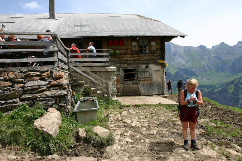
Make sure you are well equipped with food and liquid on this walk as, after the Allmenalp, the only opportunity for simple refreshments is at the farm on the Golitschenalp on the way down.
After about a kilometre up the valley, the path to First turns off sharply to the right, ascends steeply, and then traverses horizontally to a hut at 2027m. Friendly sheep will often be found in the vicinity. From the hut, the path turns left and ascends steeply up the mountain with many zigzags before it finally reaches the summit ridge. The summit is a short distance along the ridge, and lunchtime with superb views will be enjoyed there by several people on a fine day. Beyond the summit, the short steep rocky descent down the narrow ridge to the col between First and Horoang is safeguarded by wire handrails and ropes. The path then traverses downwards on scree and rock slopes around the back of Horoang before it reaches grassy pastures at a col from where a path descends to alps above the Adelboden valley. Continue up a short ascent to the summit of Stand, another fine viewpoint. From there, it descends steeply to the left, before traversing horizontally across the steep North face of Stand to reach the Golitschenpass.
From the pass, there is a good path down the 1000m to Kandersteg, leading initially down the alp to the farm, and then to the right down to a little valley where a stream is crossed. Watch out for a rare distinctive bird, the wall creeper, which flies like a butterfly. The path then traverses a pasture with a hut before descending steeply down to Höh, 1337m, where there is a welcome bench and a choice of paths down to different parts of Kandersteg. The walk is not a great distance, but it is a total of about 910m uphill and a long 1400m down, so that you should allow a time of at least 7h to take advantage of the great photographic opportunities – Kandersteg and Adelboden valleys from above, the Oeschinen valley with its lake and peaks across, and the many mountain peaks including the snowy north face of the Balmhorn.
Make sure you are well equipped with food and liquid on this walk as, after the Allmenalp, the only opportunity for simple refreshments is at the farm on the Golitschenalp on the way down.
| Time | Height | Location | Comment |
| 09:15:00 | 1175 | Allmenalp cable car base | |
| 09:30:00 | 1725 | Undere Allme cable car top | |
| 10:20:00 | 2027 | Hut | |
| 10:35:00 | Slopes above hut | 15 mins rest | |
| 12:30:00 | 2548 | First summit | Lunch |
| 13:20:00 | Depart summit | ||
| 14:10:00 | 2230 | Path junction | |
| 14:15:00 | 2320 | Stand | |
| 14:35:00 | 2180 | Golitschenpass | 15 mins rest |
| 16:20:00 | 1337 | Höh | 10 mins rest |
| 16:50:00 | 1175 | Kandersteg station | |
Edit | Attach | Print version | History: r7 < r6 < r5 < r4 | Backlinks | View wiki text | Edit wiki text | More topic actions
Topic revision: r6 - 28 Jun 2010, JaneCurry


- Toolbox
-
 Create New Topic
-
 Index
Index
-
 Search
-
 Changes
-
 Notifications
-
 RSS Feed
-
 Statistics
-
 Preferences
Ideas, requests, problems regarding Walking Wiki? Send feedback