|
|
You are here: Walking Wiki>Walks Web>WalksList>WalkPage43 (06 Aug 2018, JaneCurry)Edit wiki textEdit Attach
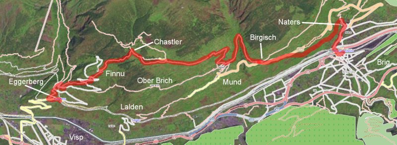
43: Hohenweg Sudrampe - Eggerberg - Eggen - Finnu - Kastler - Roose - Mund - Naters - Brig
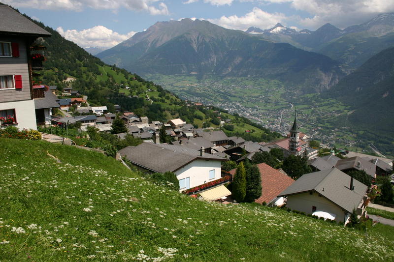
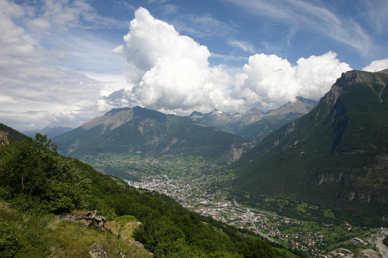
The southern end of the Höhenweg Südrampe from Eggerberg down to Brig The view down into Brig and across to the Simplon Pass from the Höhenweg Südrampe: As with the northern part of the Südrampe, there are lots of variations to this walk. The Höhenweg Südrampe used to stop at Lalden but has now been officially extended down to Brig. The walk starts at Eggerberg and goes higher up to Finnu and Kastler (Chastler) and then drops lower all the way down to Brig. It is a long walk but with a superb mixture of high alpine Walliser villages through to the almost Italian feel of Brig. The railway station at Kandersteg can sell you a ticket for Kandersteg to Eggerberg, returning from Brig.
From Eggerberg Station, follow signs for Eggen and Finnu (you may also see this written as Finnen). It is quite a hard climb from Eggerberg to Eggen as you have 200m to gain, crossing the road several times on the steep path. Eggen is a fascinating Walliser alpine village - make sure you go up the grass path through Eggen, rather than staying with the road. At the top of Eggen, go past the Wirtschaft Egga restaurant, following signs for Finnu and Kastler; it is another fairly hard climb, crossing the alpine road three times before finally emerging at Finnu. This is the highest Walliser village that is inhabited all the year round and the views are magnificent over the Rhone valley. There is a restaurant at Finnu. If you really want to cheat, it is possible to get the bus to Finnu from Eggerberg - see the Post Bus timetables - the 2017 timetable is at http://www.fahrplanfelder.ch/fileadmin/fap_pdf_fields/2017/12.523.pdf .
From Finnu, wander through the village following signs for Kastler (also written as Chastler); alternatively you can take one of the lower paths to Mund through Bodma. There are quite a lot of confusing signs around this area but they pretty well all lead to Mund eventually. It is approximately 1 km from Finnu to Kastler but you have another 200m in height to gain so the 35 minutes on the signs is a little optimistic. Kastler is the summit of this walk at 1607m - an 800m rise from Eggerberg and at least that back down to Brig. There are several paths from Kastler to Mund; Bodma is on the lower, more direct path; Roosse follows the road further before dropping down into Mund. Mund is an area where saffron is grown.
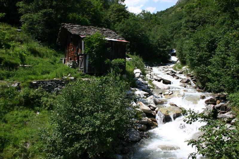
Mund is another major decision point. You can go down (due south) through Mund and head for Lalden station; the signs are not very good for this. You do NOT want to go to Lalden itself as that is down on the Rhone valley floor whereas the station is at least 150m higher up. Alternatively go through Mund heading east and pass by the old chairlift station (long disused) heading for Birgisch. You follow a beautiful path around a deeply inset valley, crossing a stream where there is a handy seat. You emerge from the valley into Birgisch where there is a restaurant and a bus stop. The Post Bus has a service that runs from Brig to Mund - the 2017 timetable can be found at http://www.fahrplanfelder.ch/fileadmin/fap_pdf_fields/2017/12.623.pdf .
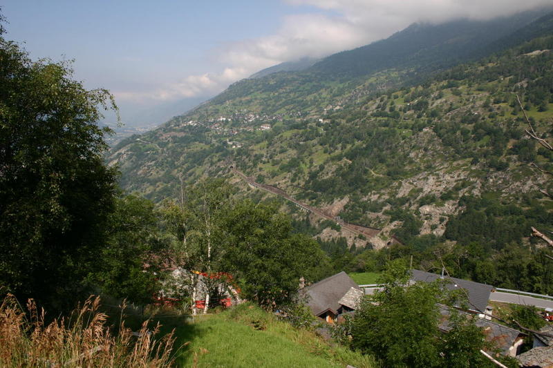
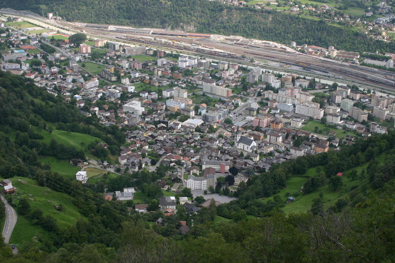
To walk right through to Brig, continue through Birgisch following signs for Naters and Brig. After following the main road for a short time, the footpath dives down the hillside to the right, eventually turning into a cobbled path in dappled shade; it emerges finally into the top of Naters, the village north of the Rhone river, opposite Brig. Follow the road (signs for Brig Bahnhof), crossing the Rhone on the main road bridge, to bring you into Brig right by the station.
This is a long walk with 800m vertcal climb in each direction. It is about 8km from Eggerberg to Mund and around 7km from Mund to Brig. It can also be a very hot walk with long stretches without a restaurant so take plenty of water. The walk Eggerberg - Finnu - Kastler - Mund - Brig is signed at about 5 hours but you will want to stop at various places to admire the view; also, be prepared to get slightly lost between Bodma and Mund - you can easily lose 20 minutes around here!
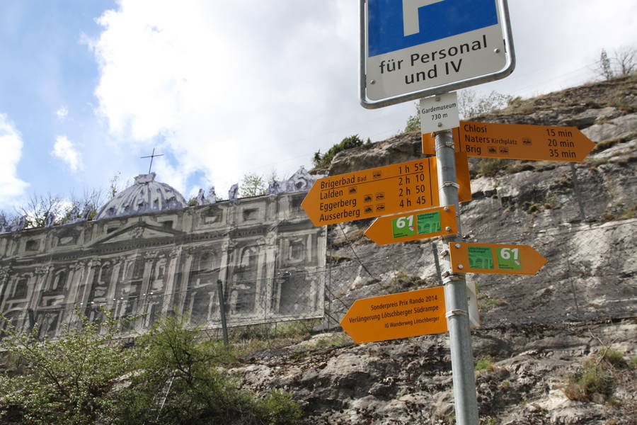
For an easier walk staying much lower, the Südrampe was extended in 2013 so it now officially continues from Lalden station down into Brig. The way is well signed with viewpoints and information boards along the way. Rather than dropping down into Naters, there is a junction off the cobbled path that takes you around a new section of path along the Kapellenweg, over a high-level bridge and down to the Swiss Guard Museum with its fascinating chimera of an old palace that looks amazingly real from a distance in Brig.
The whole Südrampe is now part of the long distance path 61, the Walliser Sonnenweg.
As with the northern part of the Südrampe, there are lots of variations to this walk. The Höhenweg Südrampe used to stop at Lalden but has now been officially extended down to Brig. The walk starts at Eggerberg and goes higher up to Finnu and Kastler (Chastler) and then drops lower all the way down to Brig. It is a long walk but with a superb mixture of high alpine Walliser villages through to the almost Italian feel of Brig. The railway station at Kandersteg can sell you a ticket for Kandersteg to Eggerberg, returning from Brig.
From Eggerberg Station, follow signs for Eggen and Finnu (you may also see this written as Finnen). It is quite a hard climb from Eggerberg to Eggen as you have 200m to gain, crossing the road several times on the steep path. Eggen is a fascinating Walliser alpine village - make sure you go up the grass path through Eggen, rather than staying with the road. At the top of Eggen, go past the Wirtschaft Egga restaurant, following signs for Finnu and Kastler; it is another fairly hard climb, crossing the alpine road three times before finally emerging at Finnu. This is the highest Walliser village that is inhabited all the year round and the views are magnificent over the Rhone valley. There is a restaurant at Finnu. If you really want to cheat, it is possible to get the bus to Finnu from Eggerberg - see the Post Bus timetables - the 2017 timetable is at http://www.fahrplanfelder.ch/fileadmin/fap_pdf_fields/2017/12.523.pdf .
From Finnu, wander through the village following signs for Kastler (also written as Chastler); alternatively you can take one of the lower paths to Mund through Bodma. There are quite a lot of confusing signs around this area but they pretty well all lead to Mund eventually. It is approximately 1 km from Finnu to Kastler but you have another 200m in height to gain so the 35 minutes on the signs is a little optimistic. Kastler is the summit of this walk at 1607m - an 800m rise from Eggerberg and at least that back down to Brig. There are several paths from Kastler to Mund; Bodma is on the lower, more direct path; Roosse follows the road further before dropping down into Mund. Mund is an area where saffron is grown.
Mund is another major decision point. You can go down (due south) through Mund and head for Lalden station; the signs are not very good for this. You do NOT want to go to Lalden itself as that is down on the Rhone valley floor whereas the station is at least 150m higher up. Alternatively go through Mund heading east and pass by the old chairlift station (long disused) heading for Birgisch. You follow a beautiful path around a deeply inset valley, crossing a stream where there is a handy seat. You emerge from the valley into Birgisch where there is a restaurant and a bus stop. The Post Bus has a service that runs from Brig to Mund - the 2017 timetable can be found at http://www.fahrplanfelder.ch/fileadmin/fap_pdf_fields/2017/12.623.pdf .
To walk right through to Brig, continue through Birgisch following signs for Naters and Brig. After following the main road for a short time, the footpath dives down the hillside to the right, eventually turning into a cobbled path in dappled shade; it emerges finally into the top of Naters, the village north of the Rhone river, opposite Brig. Follow the road (signs for Brig Bahnhof), crossing the Rhone on the main road bridge, to bring you into Brig right by the station.
This is a long walk with 800m vertcal climb in each direction. It is about 8km from Eggerberg to Mund and around 7km from Mund to Brig. It can also be a very hot walk with long stretches without a restaurant so take plenty of water. The walk Eggerberg - Finnu - Kastler - Mund - Brig is signed at about 5 hours but you will want to stop at various places to admire the view; also, be prepared to get slightly lost between Bodma and Mund - you can easily lose 20 minutes around here!
For an easier walk staying much lower, the Südrampe was extended in 2013 so it now officially continues from Lalden station down into Brig. The way is well signed with viewpoints and information boards along the way. Rather than dropping down into Naters, there is a junction off the cobbled path that takes you around a new section of path along the Kapellenweg, over a high-level bridge and down to the Swiss Guard Museum with its fascinating chimera of an old palace that looks amazingly real from a distance in Brig.
The whole Südrampe is now part of the long distance path 61, the Walliser Sonnenweg.
| Time | Height | Location | Comment |
| 10:30 | 856 | Eggerberg | |
| 11:20 | 801 | Lalden Station | |
| 12:00 | Seats and tables above Brigerbad | 20 minutes sit | |
| 13:00 | Seat above Gamsen | 30 mins for lunch | |
| 14:55 | 730 | Gardemuseum | Guard Museum. 15 minutes sit |
| 15:45 | 678 | Brig Bahnhof | |

| Time | Height | Location | Comment |
|---|---|---|---|
| 10:20:00 | 810 | Eggerberg | |
| 10:56:00 | 1017 | Eggen | |
| 12:05:00 | 1408 | Finnu | 25 mins rest |
| 13:06:00 | 1606 | Kastler | 30 mins lunch |
| 14:13:00 | 1407 | Roose | |
| 14:38:00 | 1200 | Mund | 20 mins rest |
| 15:40:00 | 1091 | Birgisch | |
| 16:22:00 | Base of track before Naters | ||
| 16:40:00 | 678 | Brig station |

Edit | Attach | Print version | History: r13 < r12 < r11 < r10 | Backlinks | View wiki text | Edit wiki text | More topic actions
Topic revision: r13 - 06 Aug 2018, JaneCurry


- Toolbox
-
 Create New Topic
-
 Index
Index
-
 Search
-
 Changes
-
 Notifications
-
 RSS Feed
-
 Statistics
-
 Preferences
Ideas, requests, problems regarding Walking Wiki? Send feedback